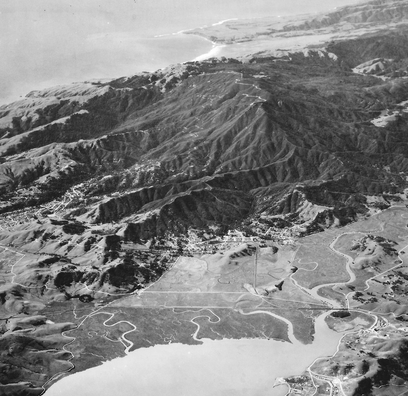
Corte Madera, Larkspur, and Mill Valley from 15,000 Feet 1926-1928
Photo Courtesy of Laurie Thompson
Everything was built above the tideline in those days
Photo Courtesy of Laurie Thompson
Everything was built above the tideline in those days
Orientation
At lower right is Point San Quentin and the State Penitentiary. The summit of Mt Tamalpais is directly above San Quentin Point and below Point Bolinas. A portion of Stinson Beach also shows at the top. All the development is above the tideline.
|
locations
Going toward the right from Mill Valley is the Corte Madera grade and the town of Corte Madera at the foot of Corte Madera Ridge. The city of Larkspur is seen in the foothills below Mt Tam. Bon Air Hill is seen at the right-hand edge of the photo.
|
landmarks
The vast floodplain of Corte Madera Creek and the adjacent tidelands would later be filled by demolishing nearby hills. The train tracks are visible as they cross the marsh and the old road between Sausalito and San Rafael can be seen beyond that.
|
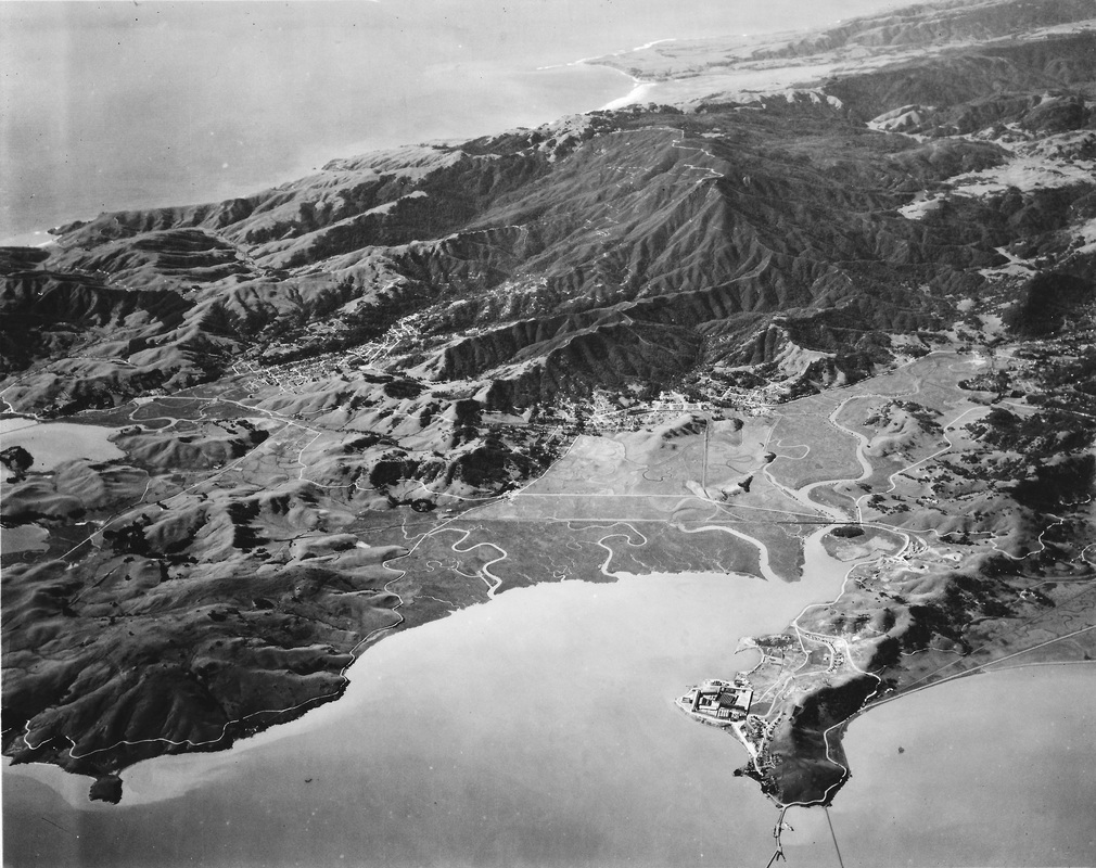
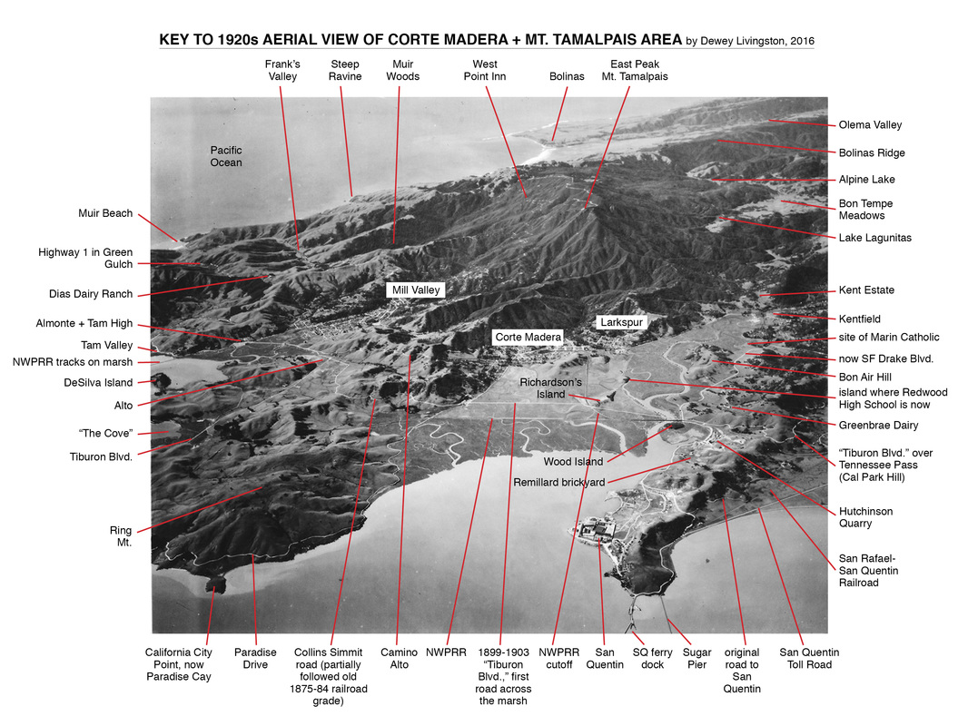
Corte Madera and Larkspur in 1926-1928, seen at center of photo, with Ring Mountain and Tiburon Peninsula on left, and San Quentin Peninsula on right. Mill Valley can be seen at upper left center of this photo, taken from 15,000 feet in 1926-1928. A helpful key to various locations in the photo has been created by Marin historian Dewey LIvingston and is shown below:
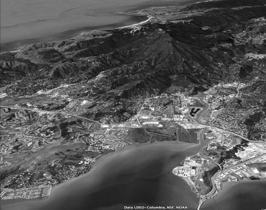
Corte Madera and Larkspur in 2016, at center of photo, with Ring Mountain and Tiburon Peninsula on the left, and San Quentin Peninsula on the right. Mill Valley, Strawberry, and parts of Tiburon can be seen on the left side of this Google Earth photo taken in 2016.