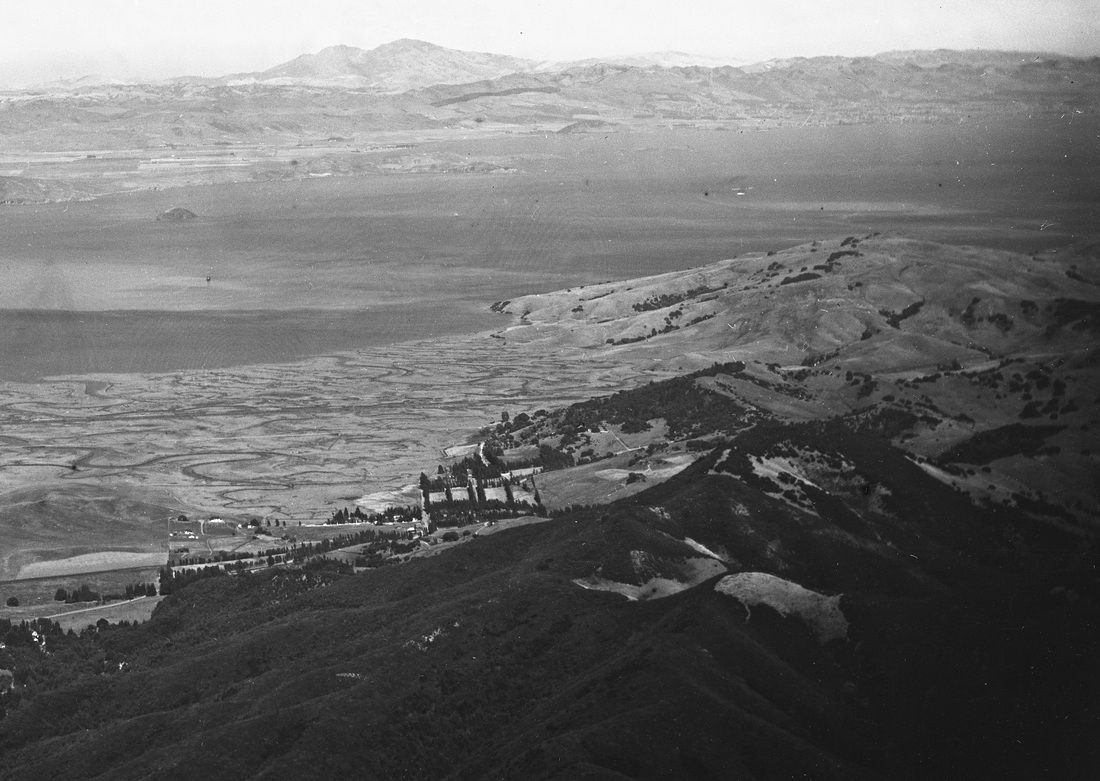
view of corte madera from east peak of mt tam
on july 17, 1899
taken by a passenger on the mt tam railroad
(from the fred runner collection)
For more than a hundred years, ever since John Reed received the first Mexican land grant, Rancho Corte Madera del Presidio, in 1834, all the permanent settlements in Marin were on the uplands above the vast tidal marshes that stretched out toward the bay. When California became a state in 1850, homesteaders established ranches and dairies on the grassy hillsides below the wooded ridgelands that flanked Mount Tamalpais. By 1875, communities began to form along the new railroad line, and speculators who bought the homesteaders' land soon laid out streets and tracts for homes that can be seen in this 1899 photo taken from the east peak of Mt Tam. They were all well above the tideline, as bay waters often overflowed the tidal sloughs and inched toward the sloping upland areas. Even when a two-lane highway was built across the marshes in the late 1920s, and the tidelands between it and the uplands were drained to be used as pastures during the growing season, there was no development on the tidelands until after the end of World War II -- a hundred years after the arrival of the first homesteaders. It changed everything.